

 By Lynn Zimmerman
Associate Editor
Editor, Teacher Education
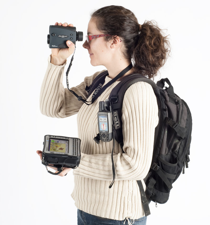
Recently, I was at an education conference in Croatia, and one of the presentations was about using geographic information systems (GIS) and global positioning systems (GPS) technology as teaching tools. The presenters proposed that this technology can be integrated in a variety of ways to create interdisciplinary lessons and projects that are technology-based. Students can learn with the GIS and GPS rather than just learn about it so that they can become producers of knowledge about the physical world around them and not just consumers of information.
One of the connections the presenters made was to the sport of orienteering to promote the development of map-reading skills and navigation. Even though orienteering is usually done low-tech with a compass and a map, higher levels of technology can create a different experience for participants.
“Field-Map birdie” by Claudiusmm – Own work. Licensed under Public Domain via Wikimedia Commons.
Of particular interest for me as a teacher of English as Foreign Language are the ways this type of technology can be used to create authentic (real-life) reading, writing, speaking and listening activities for students. The presenters made a specific point that students’ real life knowledge about nature gained with this technology can easily be represented through the medium of digital story telling, which itself integrates reading, writing, and speaking and uses critical thinking skills as students plan and develop their project.
If anyone has had experience with these types of projects, I’d like to hear about them. Post a comment to this article or email me at zimmerma@purduecal.edu
__________
A preliminary list of resources:
 Alec Bodzin, GIS and GPS Links, Lehigh University, 2/12/15.
“GIS in Education Resource Sheet,” Utah Rural Schools Association, n.d.
Jennifer Johnston, “Engineering Professor Shares Mapping Technology with Teachers,” MyVU, Vanderbilt University, 8/20/14.
Bianca Bowman, “Teacher Knowledge and Geospatial Technologies,” Conversations on Knowledge for Teaching 2015 Education Technologies: Now and in the Future, n.d.
Filed under: Uncategorized |


I was very pleased to see this article . I started using GIS and GPS in education through the National Geographic. Another classmate, Charlie Fitzpatrick is the lead education for ESRI . We have been in advocacy for use of these in educational training for at least a decade.
The White House has an initiative for schools. http://www.esri.com/connected
There is a network of alliances through the National Geographic for training in these fields in the individual alliances. There is a conference
in education which I have written about here in the journal.
While living in Germany years ago, we did some orienteering. I recently was re-introduced to orienteering in Russia, in after school programming in Samara. I thought to myself what great scaffolding
In Russia orienteering is a coveted skill which can lead to career options like being a pilot for the airlines and other jobs.
In America, in the recent Las Vegas meeting of higher ed, SITE.org AACE one of the preview field trips was a bus trip that contained the elements of orienteering, some GPS and GIS. I did not attend the trip but it seemed to be a possible step for higher ed involvement in GIS.
I took advanced training for implementation at the ESRI Conference and in their special outreach to teachers and students in K-12.
This , http://www.esri.com/events/user-conference is the main conference . There is also a smaller education conference. Both are interesting, exciting and memorable.
Sadly with the advantage of superior training in this field, doors were still slammed in adopting the free resources available. Testing trumps most technology in K-12. Hopefully there is a better sense of the use in higher ed.
Story mapping is one great application.
NFS has funded this
GRACE GIS Video Premiere
alew Level 5
alew May 12, 2015 4:23 PM
Greetings GIS educators and n@eighbors!
I am currently part of an NSF funded grant developing Professional Development for teachers together with a path toward internships for students. The GRACE team has created and entered a short video in the 2015 NSF Teaching and Learning Video Showcase. The showcase opens for viewing this week (May 11 – 15). I would like to encourage you to view the video and, if you like what you see, vote for us in the Public Choice category.
You can find the entire showcase at this URL:
http://resourcecenters2015.videohall.com
You can go directly to the GRACE presentation at this address:
http://resourcecenters2015.videohall.com/posters/555
In addition, we are asking you to share this message and link with as many of your friends and colleagues as you are able. This is a contest and the videos will be evaluated both for quality and content as well as by number of views.
Please feel free to share these links freely on school websites, school and personal Facebook pages, through your Twitter account, and via your school and personal email address books.
You may wish to view some of the other 112 videos as well and join the conversation about the latest research to improve STEM and computer science teaching and learning. You can search for videos by content, grade level, institution. You may also pose questions to the presenters, and vote for the 3-minute videos that most successfully communicate cutting-edge education research and its impact.
Thank you for whatever
support you are able to offer to our project.
Randall E Raymond
I have great photos of orienteering in Russia and of the teacher workshop that is held on the ESRI campus in Redlands. CA.
[…] “By Lynn Zimmerman Associate Editor Editor, Teacher Education Recently, I was at an education conference in Croatia, and one of the presentations was about using geographic information systems (GIS)…” […]
Our Environmental Literacy and Inquiry (ELI) group at Lehigh University has developed a series of inquiry-based middle school curricula that use geospatial technologies including GIS and Google Earth to investigate Earth and environmental science issues. The Web site includes curriculum units on Energy, Climate Change, and Land Use Change. It also includes a series of Web GIS Tectonics investigations designed to enhance the middle level Earth science curriculum.
The curriculum is freely available at:
http://www.ei.lehigh.edu/eli/
Our group has conducted a number of research studies to assess the effectiveness of the curriculum to promote geospatial thinking skills and improved content knowledge. A list of references are available at:
http://www.ei.lehigh.edu/eli/research/pubs.html
Thanks to you and others for sharing. I had no idea this was such a well-developed topic!